
Update, 26–27 October 2026. The multiplayer roster has grown to twenty-one maps, including the 3,000 × 2,520-world-unit Shogun Highlands. The twenty-map atlas described below records the earlier stage of development. Browse the current roster.
Update — 25 October 2026: SHADOWFRAG now includes Shogun conquest, Shogun Highlands and Precision Dojo. Read why we describe it as a Movement FPS and explore the current 21-map roster.
A map page should help someone decide where they want to play. A concept image can suggest an atmosphere, but it cannot show the cover along a route or how two platforms connect. I built a repeatable way to capture maps from the game so the atlas could show the geometry a player would actually encounter.
The original atlas covered 20 playable development maps, each with a scene view and an overview produced by the Vulkan renderer. Including a map in that collection was not a public-release announcement.
Seeing the space and the route
A scene view shows height, materials and atmosphere from closer to the player's perspective. An overview shows where a route leads and how it connects to the rest of the map. I wanted both views because an appealing courtyard does not, by itself, explain how you can move through it.
The eight core maps covered different kinds of space. Lantern Yard offered room to practice and Ironworks used industrial lanes. Twin Castles combined forest crossings with a waterfall passage. Ninja World and Cloud Dojo focused on courtyard routes, while Foundry and Sanctuary provided different demolition spaces. Fallen City spread the scroll objective across an abandoned district and the surrounding countryside.
The twelve classic-layout adaptations explored other arrangements. Sandgate, Moonspire, Jade Deck, Sky Temples and Windwalk used crossings, towers, layered interiors and vertical combat. Redstone Gulch, Firefly Village and Twin Keeps gave flag returns and flanks different shapes. Tidebreak, Stormdance, Cloudbreak and Sun Aqueduct opened up coastal and outdoor routes.
Keeping the images tied to the maps
The capture records retain a geometry hash, a fingerprint of the layout used for each image. When a map changes, I can regenerate its views from the renderer and keep the pictures attached to the right version. Search, collection filters and the overview switch make those views useful for browsing as well as for maintaining the site.
The capture work also produced weapon portraits, avatars and controlled movement demonstrations. Those demonstrations use the same movement prediction as the game, but run on an isolated stage with a tracking camera and reduced playback speed. I label those choices so a controlled demonstration is not mistaken for a live match.
You can open the atlas to compare the routes as well as their appearance. Map size and server capacity remain separate: even a wide map does not raise the game's 64-player limit.
Ironworks, then and later
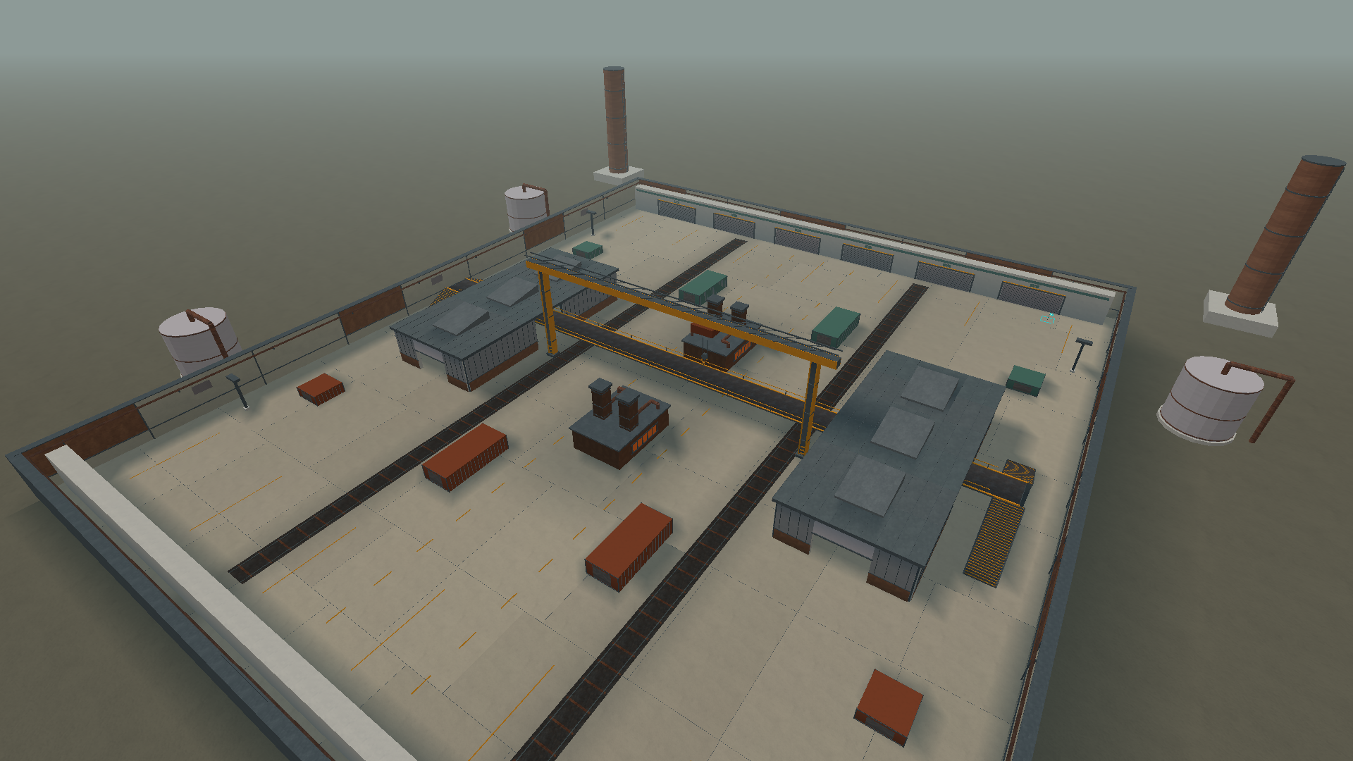
Two retained overhead views show the industrial arena across development. The cameras differ slightly, so this is a visual history rather than a pixel-aligned comparison.
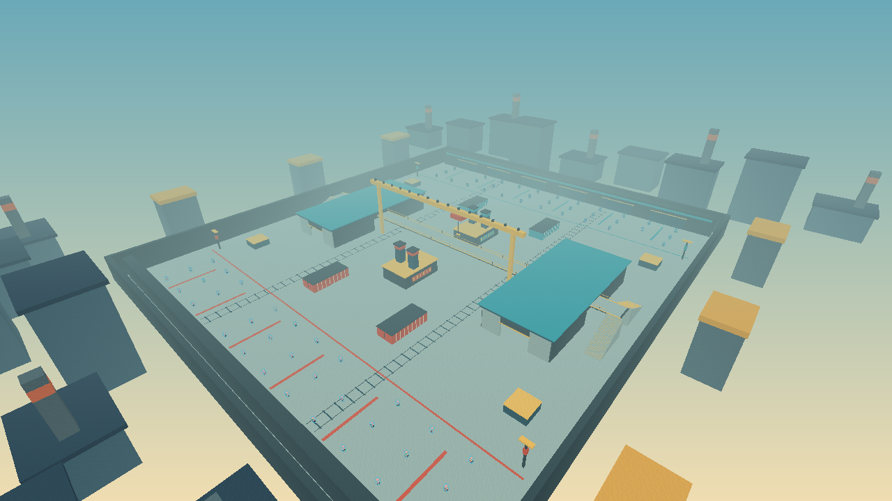
The early arena already has its central warehouse, crane and perimeter route.
Original PNG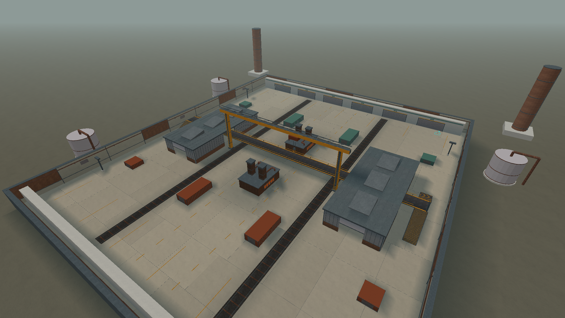
The later engine capture shows the material palette, roof detail, tanks and industrial skyline.
Original PNGA material pass from the same approach
This pair uses matched viewpoints from the retained Ironworks quality pass. Surface treatment changes the character of the yard without hiding its routes.
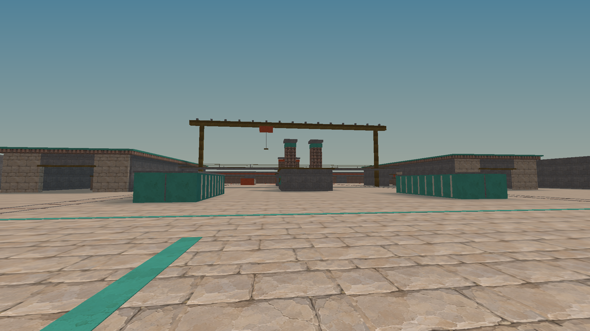
The earlier approach uses stone-like paving and broad teal ground marks.
Original PNG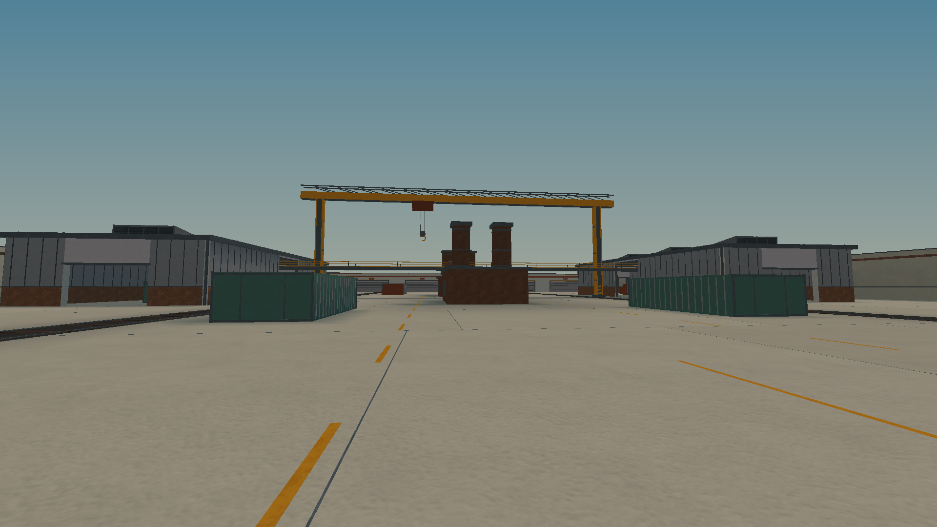
Concrete, lane paint and metal warehouse surfaces give the same approach an industrial vocabulary.
Original PNGStill-image archive dates come from retained image file timestamps in Los Angeles time. An earlier-dated article may include later builds; each image is dated separately. Images are genuine engine or native-editor output. Download sources, transforms and SHA-256 hashes.